Thursday, February 17, 2005


This is the new fashion outfit for the spring season. Liam, one of our guides applied the nosepiece tape for "extra protection". The hole in the back is where we started our rappel. I like the Skywalker boots. They were suprisingly grippy on the wet rock.

Rappelling 100-meters into the Lost World at Waitomo. I had to break out the gasmask inserts from Baghdad, because, "I knew things were going to get a little hairy."

Waiheke Island

I ended up going to a Maori Village while in Rotorua to attend a show and to enjoy a nice hangi. A hangi is the way the Maori used to cook feasts. This involved heating up rocks in a fire, throwing it in a deep hole with some food, and covering the hole with wet leaves to let the steam cook the food. The dance and show was pretty awesome. They showed us a haka, which is their war dance, and all their different weapons and tactics. The food was pretty good as well. We had some chicken, lamb, potato, and kumara, a type of sweet potato. I stuffed myself.
The next day I headed to Waitomo Caves, an area with a lot of limestone sinkholes. I signed up for the Ultimate Lost World tour with Waitomo Adventures. This was a seven-hour trip with a 100 m rappel into a huge hole. It was great. We then hiked upstream through an underground cave and river. We wore helmets, headlamps, and thick wetsuits. The water was pretty cold, but the wetsuits were thick. We ended up crawling, climbing, swimming, and jumping off of waterfalls, all underground. When we turned off our headlamps, all we could see were glowworms, small pinpoint maggots on the walls. It was a blast. Hours later, we came out of a cave, two kilometers from our starting point. We finished the day with a nice barbecue.
The next day I took a four hour bus trip to Auckland, and then walked to the wharf to take a ferry to Waiheke Island. Waiheke Island is a large island in the Hauraki Gulf. The ferry ride is about 35 minutes long and takes you so far away from the city. I had planned on being here for three nights, but I've decided to spend six nights here. There are many coves and hidden beaches here, most of them are next to million dollar estates, summer homes for the elite of Auckland. There is wonderfully, not much to do here, so I have been relaxing and preparing for the next phase of my trip. In a couple days I will head to Auckland, and then after that...you'll see.

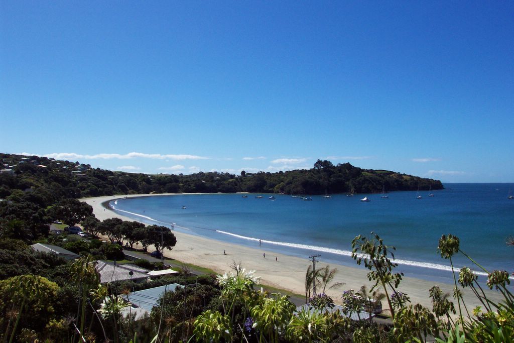
Oneroa Beach on Waiheke Island. Twenty miles, or a 35-minute ferry ride from downtown Auckland. It is a world away from the city. Quiet and peaceful.

Craters of the Moon, a geothermic place with steam vents and bubbling mudpools.

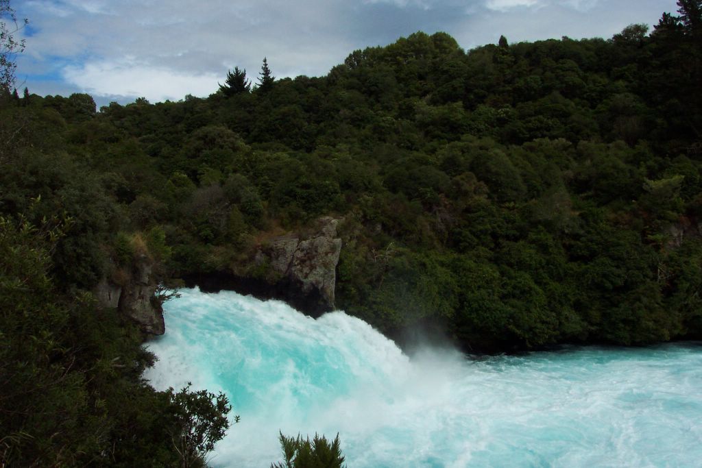
Huka Falls. Not really that high, but pretty turbulent.

View of the Emerald Lakes, Blue Lake, and Lake Taupo off in the distance from Red Crater on the Tongariro Crossing. The mist is actually from thermal vents and cracks just off the trail.

There is a trail of people hiking to the top of the Mangetepopo Saddle to the left of Mt. Ngauruhoe. The scree sloped I hiked up was along that rocky ridge below the red band to the left of the peak of Mt. Ngauruhoe.

Mt. Ngauruhoe, aka Mt. Doom.

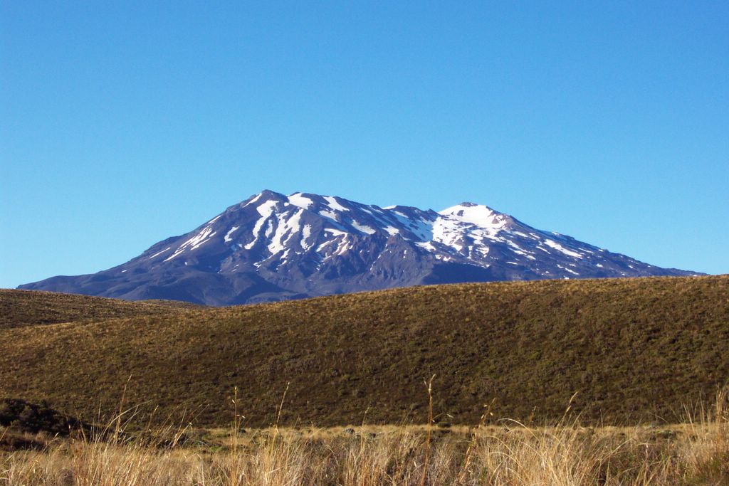
Mt. Ruapehu. I hiked to the crater rim on a foggy day.

Sunday, February 13, 2005

Tongariro and Taupo

I went to National Park Village after Wellington. I was there to do the Tongariro Crossing. It's a 17 km hike between Mt. Tongariro and Mt. Ngauruhoe. This is supposed to be the best one-day hike in the North Island, but it's often shrouded in clouds. When I got there it was raining, and the weather forecast predicted clouds for the next day, so I hitchhiked to the Mt. Ruapehu ski lifts about 15 km from National Park Village. They filmed some more the LOTR movies there, but I couldn't tell you where or what. Mt. Ruapehu, like all the other mountains in the region, are volcanos. Mt. Ruapehu last erupted in 1996. It doesn't have a proper peak, but it does have a huge crater, so I hiked up through the ski resort to the crater rim, where I found myself in a near-total white out. Visibility was about 20 meters, so I decided to find my way back down in the mist.
The next day I went and hiked the Tongariro Crossing. It was pretty crowded on the track. I made a side trip to hike to the top of Mt. Ngauruhoe, which was used as Mt. Doom. The clouds came in halfway up the peak, so I didn't get much of a view, but I had a blast sliding down the scree slope to the bottom. The Tongariro Crossing track was amazing passing though a couple craters and steaming volcanic vents.
The next day I went to Taupo, a city on the northern edge of Lake Taupo, the largest lake in New Zealand. It is stocked with California Rainbow Trout. These monsters are huge compared to the ones in California. I am not sure why. They get up to 20 lbs, I am told. They look like salmon. I didn't do any fishing, but I hiked to a place called Craters of the Moon, which was another geothermic area where I could see (and smell) steaming vents and bubbling mudpools. I also walked to Huka Falls, which is on the Waikato River, which empties out of Lake Taupo. The Falls were very impressive, if not exactly high. The river narrowed from 100 m across to 10 m across, making a very turbulent channel. I also got to bathe in the natural spa that emptied into the pristine waters of the river. That was pretty cool.
I came to Rotorua last night. This is known as Sulfur City because it's sitting in a huge crater and there are geothermic hot springs everywhere. Everywhere? yeah, like in people's yards and stuff. It's funny because if you have a hot spring on your property, you just throw some rocks on it so you know not to walk over the vent and burn yourself. It also stinks like rotten eggs here, but it's not as bad as it sounds. Well, maybe it is.
I am not sure where I will be going next, but chances are I'll be headed to the Waitomo Caves to do some caving.

Sunday, February 06, 2005


Look at that hair! I don't have a comb and I haven't enough shampoo. That's a perfect combination for dreadlocks, I'd say! This is actually at the Embassy Theatre where they had the premieres for the LOTR movies.

The free Bob Marley "One Love" tribute concert on Waitangi Day.

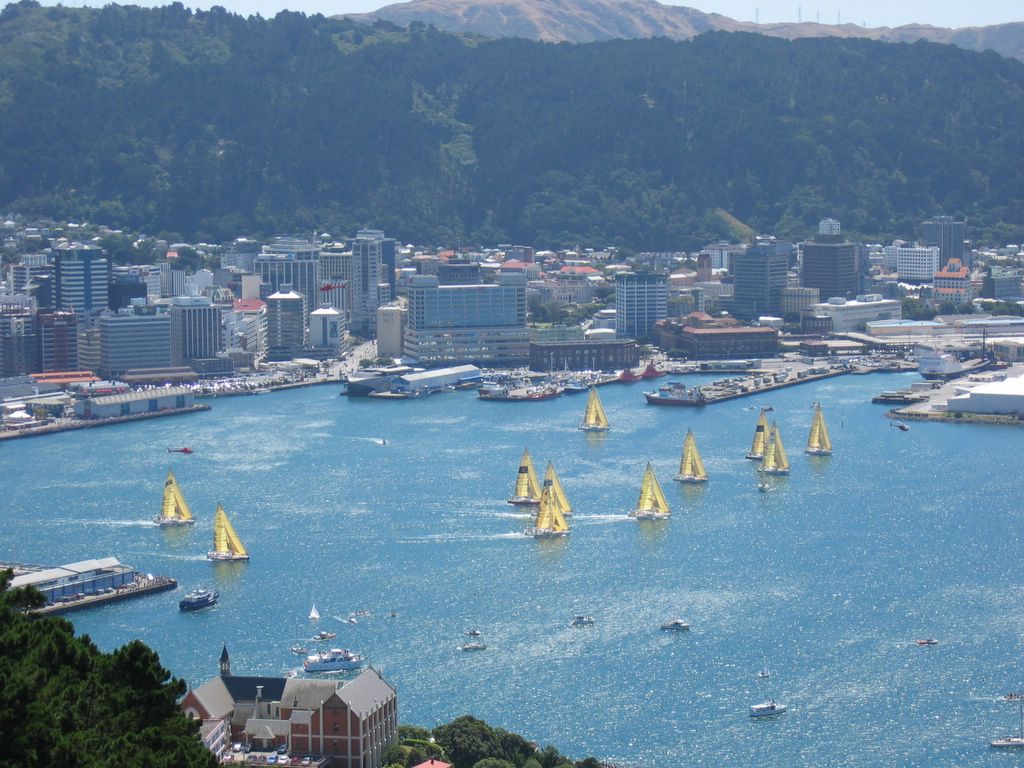
The boats after a few minutes into the race.

The 12 boats tacking for position before the starting gun.

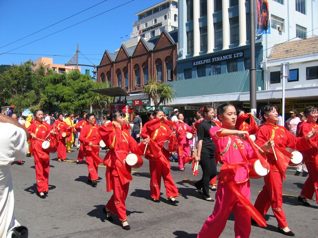
The Chinese New Year parade in Wellington. My dad tells me that Chinese New Year is actually February 9 this year.

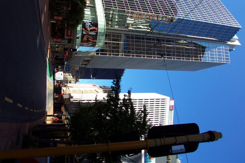
Wellington has more than 100,000 fewer people, but looks more like a big city. Maybe that's because it's the capital of New Zealand.

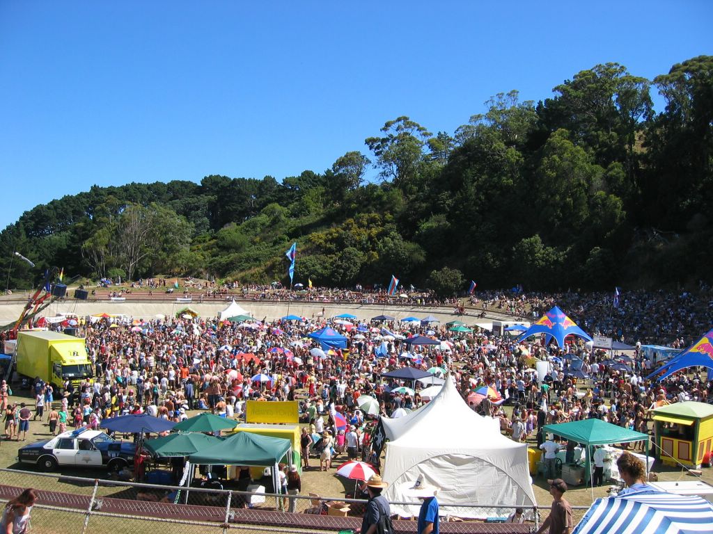
During the Sevens, most groups of people seem to dress up in wierd costumes. and drink. They drink a lot. and they don't sleep very much.

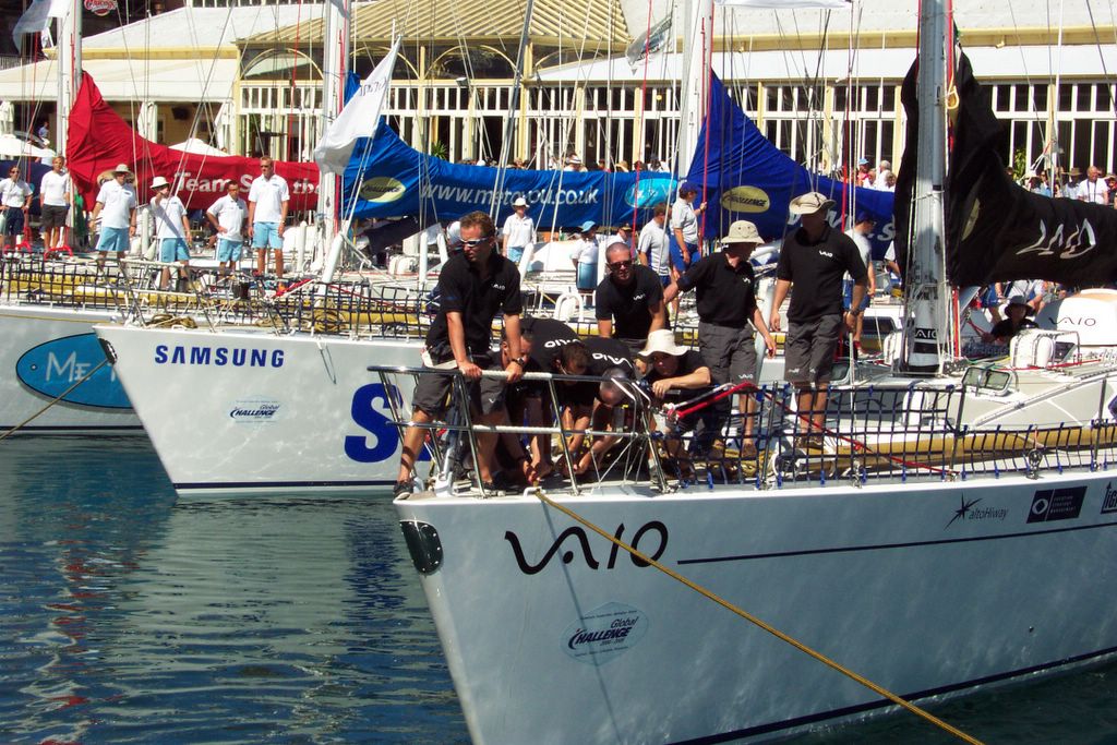
The Vaio team struggling to pull their lines. Who's steering thing?

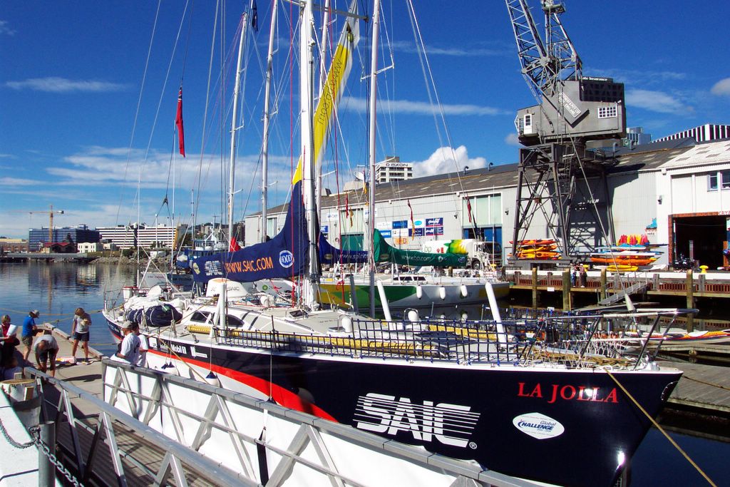
The SAIC boat crew, 18 in all.

The SAIC-sponsored boat. SAIC is a company in La Jolla, which is where I went to school in San Diego.

The lovely city of Wellington from Victoria's Lookout.

Who is Wellington named after? I don't know, but...

I will have spent five nights in Wellington. That's a lot more than I had initially expected, but it was a good weekend, and I happened to find a cheap place to stay. I spent a couple days going to Te Papa, the big museum in town (it's free like most of the museums in New Zealand and Australia). It takes a couple days to see it all. I think Te Papa means "our place", but don't quote me on this. Anyways, it's a museum about New Zealand. It cost $317 million to make, so you can be sure that it's pretty nice and well worth the visit.
The rugby sevens were in town and the tickets were sold out. That's okay, because they don't black out games like they do in the States. I was able to catch a few of the 20 minute matches in the evening. The States were represented, but they didn't do too well. They lost all three matches, getting shut out by the Kiwis (43-zip). The Kiwi's or, All Blacks, as they are known, went on to win the tourney. They did a victory "haka" after they won. It's a pretty cool Maori tribal tradition. There is a lot of bare chest slapping and stomping. If you've seen Whale Rider, you kind of know what I'm talking about. The Kiwi's, by the way, are fanatical about their All Blacks rugby team. It's the national team that goes to compete in international competitions. They seem to cream the competition. The Sevens brings in millions of dollars for Wellington, and the bars were pretty packed. A lot of groups of people dress up in wierd matching costumes, some of which are pretty outragous. It's like a big costume party where they drink a lot.
The weather was pretty hot this weekend, contrary to the weatherman's predictions. I was able to watch the Global Challenge boats take off today from their docks, and then I hiked to the top of a peak to catch the race in the bay. These boats are 72-feet long and are all identical, so that it's skill and luck that makes the winner. They're crewed by 17 "volunteers" that compete for these prized spots four years prior to the race. Their skippers are the only required professional sailors on board. The crew pays about $70,000 each to be on board for the year. Most of them find sponsors to help pay their way. They're going around the world "the wrong way", that is, from east to west, which is supposed to be harder. They spend a good length of time in the Southern Sea with ice on their ship. Awwwesome.
There was also a Chinese festival celebrating the upcoming New Year on the lunar calendar. I went to the One Love festival today (Waitangi Day). I will be headed to National Park, the town just outside Tongariro National Park, tomorrow. The weatherman is calling for showers for a couple of days, but I am hoping that he is going to be wrong like he was about his "cloudy and cool" weekend in Wellington.
Oh and as you can see, I have updated some pictures. I have tried to put them in sequential order by backdating them. You can check the archives to see if you have missed any.

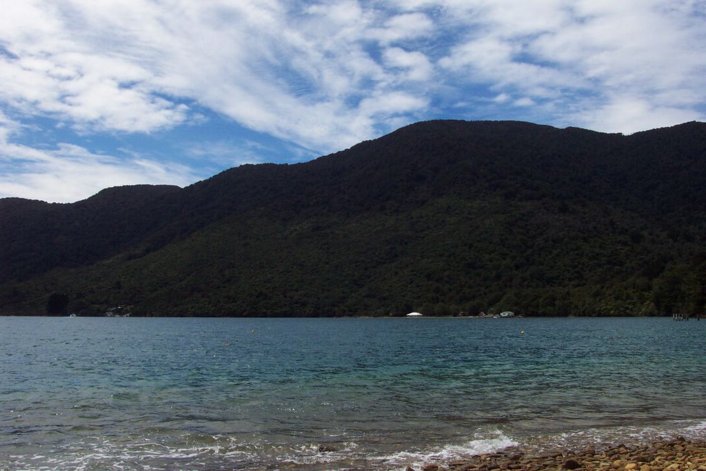
Bay of Many Coves. Yes, that is the name on the map.

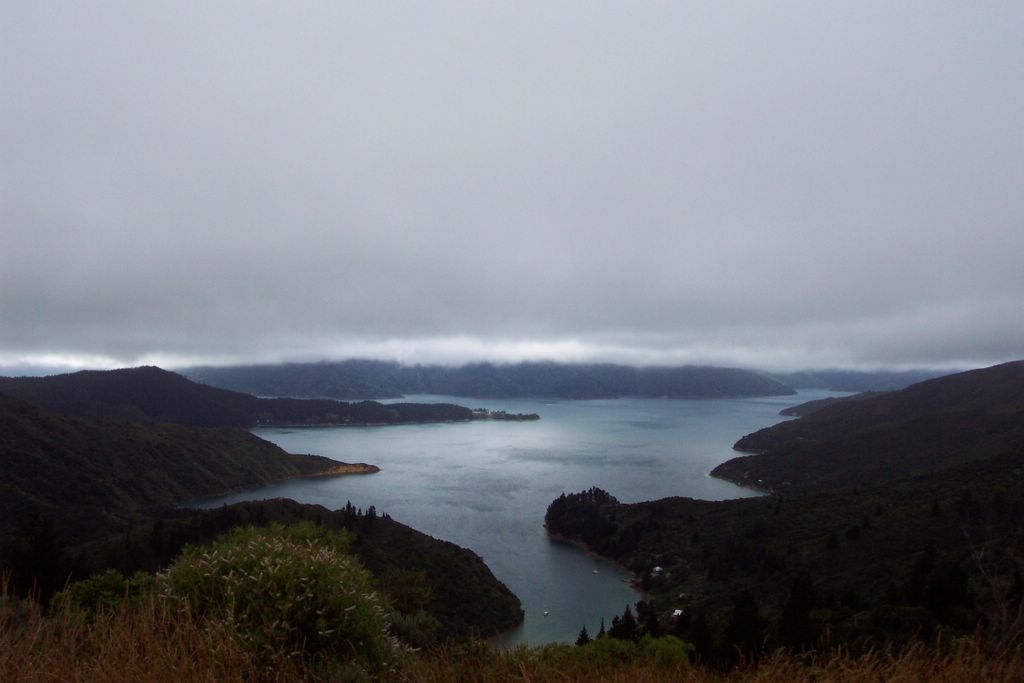
Sunlight peeking through the clouds over the Charlotte Sound.

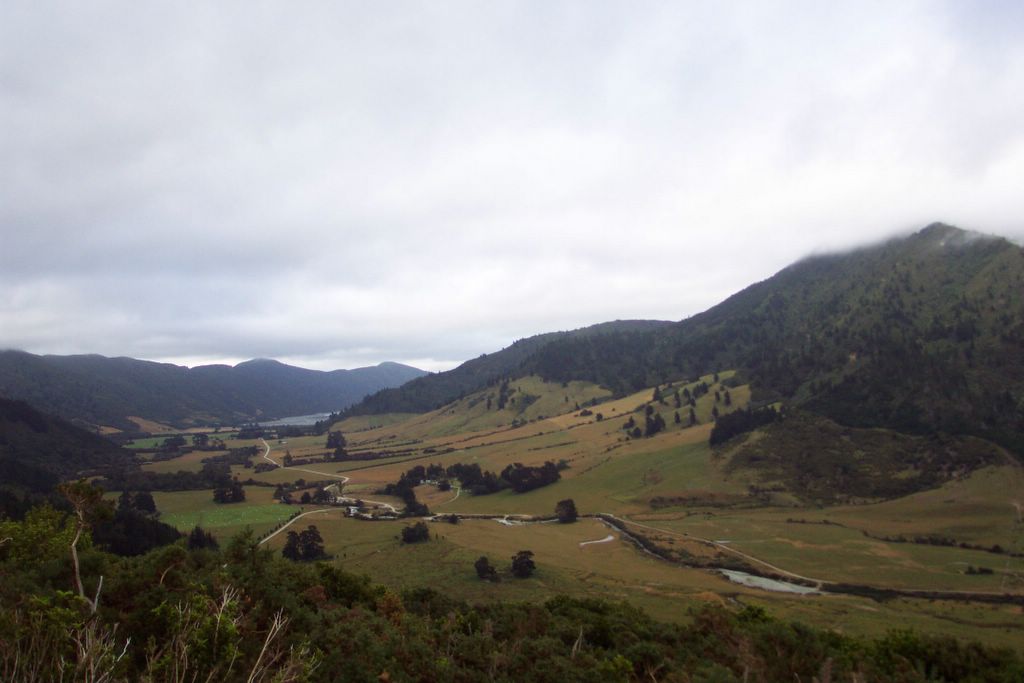
This valley leads to the Keneperu Sound, which is on the other side of the ridge. Yes, I am making up these names as I go along.

This is Punga Cove, the place I stayed the second night. The clouds came in and it drizzled on and off for the next couple of days, which was nice because it was hot and humid when it stopped drizzling.

Endeavour Bay at Queen Charlotte Sound. This is where I stayed the first night on the Track. The track follows the coast in some areas, but mostly stays up high crisscrossing the ridge.

Wednesday, February 02, 2005

Queen Charlotte Track

I spent the past three nights on the Queen Charlotte Track in the Marlborough Sound. It's a trail that has camping sites and lodges on it, that runs along the coast and ridge of a strip of land in the Marlborough Sound. It's about 71 km long. I took a ferry out to Endeavour Bay, which is about 4 hours from the start of the track (the ferry people said it was too late in the day for them to go to the very start). From there, it was about 57 km to the end. I got there about 2:30 pm and just hiked around the area, but the next day I only had 12 km to the next lodge so I ran the whole way. It was great to be running again; it's been about a month since I last went running. I think all the hiking I've been doing has gotten my legs in shape. I spent that day lazying around the jacuzzi. The next portion was about 24 km long to a place called Portage. It was pretty cloudy that day, but I made it in just over four hours. Shortly after I got to the lodge, it started drizzling, and it continued all day long well into the next day.
Today I only had 20 km to go to the end. This route is great because you can pay the ferry to take you out to the start and transport your pack to your lodge everyday. Yes, this is what a lazy man does. It was fantastic.
I took the interisland ferry from Picton to Wellington this evening. It was only 2 hours and a half hours to cross Cook's Strait. Now, I'm in the North Island. I'll be in Wellington (the capital) for the next few days. There are a few interesting things going on this weekend. First of all, there is a rugby tournament going on called "seven" which means they have seven people on each side instead of 15 (?). It's made finding accommodations kind of tricky. I will be changing hostels everyday for the next couple days. The tourney goes on Friday through Saturday. Saturday happens to be Chinese New Year, I just read. Sunday is Waitangi Day, which is sort of like their July 4th, except not really. The Treaty of Waitangi is an agreement between the Pakeha (the European settlers) and the Maori, but it's been hotly contested ever since its signing back in 1840. Anyways, I think there will be a bunch of festivities going on. Also, the third leg of the Global Challenge kicks off from Wellington on Sunday, so I will try to catch that as well. That's a big round-the-world yacht race. Anyways, those are my plans. Hopefully the weather will improve because it's been kind of drizzly the past couple of days.


Saturday, January 29, 2005


Just another beach at Abel Tasman.

Cleopatra Pools, where you can take a freezing swim to wash off the sweat. Or not.

Torrent Bay as it is filling up. I had hiked across from the right side to the left a couple hours prior to this photo.

Torrent Bay. When it empties out at low tide, you save about 70 minutes of hiking by cutting across the mudflats. The mudflats are littered with empty clam shells from the sandpipers. The low tide leaves the boats all high and dry.

Anchorage Bay at Abel Tasman, where we slept on a houseboat overnight. The biggest boat in the bay is the houseboat.

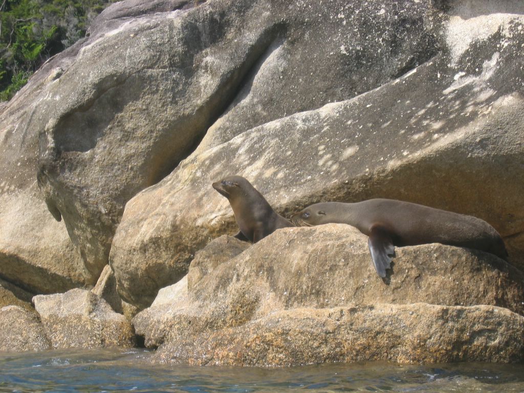
Seals sunning themselves on the rocks. I forgot to pack my bat. Just kidding...

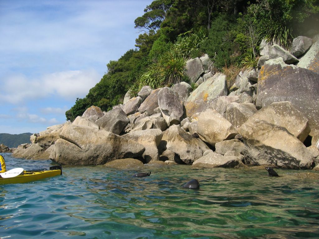
Three seals saw us and slipped into the water to check us out. They proceeded to scratch their butts at us.

Kayaking in the Tonga Marine Reserve at Abel Tasman National Park. That's a seal doing the backstroke next to us in the water.

Abel Tasman National Park

I'm back in Nelson again, but I spent the past couple nights at Abel Tasman National Park. This is one of the most popular backpacking trails in New Zealand. It's a three to four day hike on the coast with some awesome views of jungle and beach. I signed up for a catered kayak trip to a marine reserve and got to swim around in the freezing water. We had some close encounters with seals that slipped into the water to check us out. It was pretty amazing to be a few feet from them. It was a pretty small group of us (four tandem kayaks). The conditions were perfect. It was really glassy in the morning, and in the afternoon the wind picked up, so we formed a flotilla and put up a sail and held on tightly and sailed into our cove. We had a couple races and our boat won. It didn't hurt that my navigator (steering with pedals) was actually a Canadian from Newfoundland with a season of sea-kayak guiding under her belt.
I got to stay on a houseboat with some guests. It was so different from the Whitsundays, in Australia. We had a nice BBQ and then settled in with warm drinks on the deck talking to Danes, Swiss Germans, Dutch, and a Canadian. It was nice and cool at night so we bundled up below decks under the comforters.
Today I hiked to a couple sights and then on my way out of the park.
Tomorrow I head to Picton and hopefully spend a few nights on the Queen Charlotte Track.

Tuesday, January 25, 2005

View from Mt. Beasley

View from Mt. Beasley

Once again Mt. Rollerston in the background and Avalanche Peak to the right of Mt. Rollerston. The traverse continues down the left ridge from Avalanche Peak to Lyell Peak which is near the center of the photo, and then along the ridge all the way to the left of the photo, then zig-zagging along that knife blade ridge toward me. This has been the best hike I've done so far. The views and the exposure and route-finding made it incredibly exciting.

View of Mt. Rollerston from Avalanche Peak

View of Mt. Rollerston from Avalanche Peak

This is supposed to be the best day hike in all of New Zealand according to the Lonely Planet. They have a race called the Avalanche Peak Challenge here every year. The winner usually makes it up in 55 minutes; it took me 90. Oh well. The hike is pretty good, but I ended up doing a traverse along the ridge over to Lyell Peak and Mt. Beasley. It was pretty exposed on this knife ridge, but fortunately there was hardly any wind. And of course, no one on this traverse.

Atop Mt. Aiken (1863 m)

Atop Mt. Aiken (1863 m)

I blazed up this peak from Arthur's Pass. Once again, there was no one else on this trail. From the top, I had a 360 view all around wiith no evidence of human encroachment except for a few buildings in the valley of Arthur's Pass.

Warm in Nelson

After three nights in Arthur's Pass (760 m elevation), I've taken the seven hour trip up to Nelson, which is at the northern coast of the South Island. Arthur's Pass was pretty cold the first night, but there was a toasty coal stove heating the lounge. It's a small village there with one store/gas station and a couple hotels and a couple hostels. I got to do a couple stiff day hikes there, visiting both sides of the valley. The first hike was to Mt. Aiken at 1863 m, then the next day I hit Avalanche Peak (1833 m), Lyell Peak (1828 m), and Mt. Beasley (1836 m). Now my Achille's tendons are paying the price. I was totally inspired by three guys I met the first night. It was cold and rainy, but they had just done a training trail run (25 km up to 1050 m) in preparation for the Coast to Coast challenge, a one-day 255 km race in a few weeks. It's one of those multisport races with trail running, river kayaking (class 2), and road-biking. These guys set off to kayak for five hours the next morning.
Now I'm in Nelson to head to the Abel Tasman National Park, but I still have to figure out what I plan on doing there.

Fern trees in the rainforests next to the glaciers. The silver fern, by the way, is the national symbol for New Zealand. I'm not sure if I've encountered an silver fern during my hikes. I did encounter trees like these in Australia in the Daintree National Park. They tell the tourists that these mighty trees grow about one to three centimeters a year. I don't know if this is true or not, but you can tell the age of the tree by its height. There were signposts showing where the glaciers had receded from 1950 and even 1750. You could tell that the trees in those areas were clearly of limited height, so maybe it's not a bunch of crap they tell the tourists.

Franz Josef Glacier

Franz Josef Glacier

I hiked up to Robert's Point above Franz Josef. This glacier is actually creeping forward about 1 meter a day. This is right next to a rainforest. There are a million helicopters buzzing around above taking tourist up for a view of the mountains and taking them on jaunts along the glacier.


More sheep we encountered on the bus. Sometimes traffic comes to a complete halt because of grazing animals crossing the roads. I did not encounter a single multi-laned highway in the South Island.

Mt. Aeolus

Mt. Aeolus

This was just a 15 minute stop on my bus ride from Queenstown to Fox Glacier, but it was so pretty I had to take a picture.


A rainy day in the Milford Sound. It's supposed to be pretty impressive with the big waterfall. It's a fiord. Whatever.

View from Ben Lomond Peak

View from Ben Lomond Peak

This is a peak right behind Queenstown. This view overlooks the town of Queenstown below and the Frankton Arm which is that thin slice of Lake Wakatipu that extends to the right. This lake is huge, by the way. It was hailing and very windy up here. I was wearing shorts. The trail I took comes along the ridge that you see above Queentown, which is the town on the bottom part of the lake. This ridge goes to the bottom left side of the photo. It was really windy and exposed but easily navigable.


Queenstown and the Remarkables

Queentown and the Remarkables

This is the view from my hostel. This place was so nice that I ended up staying four nights. Amazingly this town is now well known for its high-adventure pursuits rather than it's beauty. They filmed a lot of the Two Towers in the surrounding area. The Remarkables are the peaks lit up by the setting sun. This is Lake Wakatipu, a huge lake in the South Island.

Up at Sealy Tarn

Up at Sealy Tarn

This is on the hike to the Mueller Hut. For trampers (backpackers) in NZ, you don't necessarily need a tent as they have limited spaces available in alpine huts. A tarn is a mountain lake. That's Mt. Sefton behind me and Mt. Cook to the right. Sefton appears to loom much higher, but Mt. Cook is still several miles away.

Mt. Cook from afar

Mt. Cook from afar

This is a glacial valley that was carved out by the Tasman glacier. It dumps into Lake Pukaki which is a brilliant powder blue because of the "glacial flour"; as a glacier grinds rock into powder, the fine silt goes into the water. I hiked a couple hours to through grazing sheep to get up here. No tourists anywhere.


Pancake rocks at Punikaiki. My school report on the rocks at Punikaiki is as follows:
The Punikaiki Pancake Rocks were formed hundreds of thousands of years ago. Scientists today are still puzzled on exactly how they were formed.

Friday, January 21, 2005


Mt. Cook or Aoraki "Cloud-Piercer" at sunset

Lake Pukaki and the evaporation zone. I just coined that term, by the way. The place I stayed at was about 25 km from Mt. Cook, and was located in the shadows by the lake.

I encountered some sheep while hiking to this ridge. I was sneezing the whole way up because, apparently, I am allergic to them.

Mt. Cook and Lake Pukaki. Lakes Pukaki and Tekapo have a brilliant color, but are not clear because of glacial flour. It's kind of nasty, if you think about it.